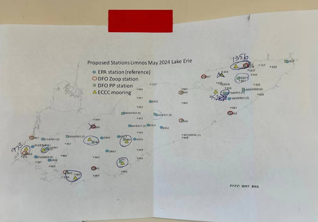
Last week, members of our team in the DFO Great Lakes Food Webs lab returned from a week-long voyage aboard the Canadian Coast Guard Ship (CCGS) Limnos for the first cruise of the Lake Erie CSMI field-year. We were joined by other interdisciplinary scientists and technicians from our federal research partners at Environment and Climate Change Canada (ECCC). Together, we zig-zagged through Lake Erie as we collected lake-wide physicochemical and biological productivity data from 17 stations spread throughout the lake. This was part of our coordinated commitment to Annex 10 (Science) of the Great Lakes Water Quality Agreement (GLWQA).
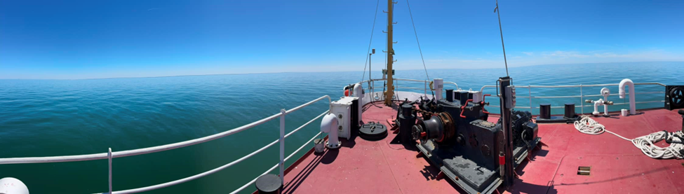
As mentioned in a previous blog post, the Cooperative Science and Monitoring Initiative (CSMI) is a binational data collection and monitoring effort that aims to bolster our scientific understanding of the chemical, physical, and biological properties of the Laurentian Great Lakes on a 5-year cycle, cycling between the lakes each field season. This year is the intensive field-year for Lake Erie monitoring, and after a year in dry dock our research vessel, the CCGS Limnos, has been successfully launched back in the water! As such, we have 3 lake-wide cruises planned for the 2024 Lake Erie CSMI field-year, including the (delayed) May cruise we just completed.

The CSMI is an interesting partnership between the Canadian and US Federal Governments which allows scientists in both nations to examine and establish lake-specific scientific research priorities. It is a good example of how science can benefit from local knowledge sharing and collaborative oversight. Aboard the CCGS Limnos, DFO also collaborates inter-departmentally with ECCC to save resources and improve the efficiency of these voyages. Months before our first CSMI sampling event took place, DFO, ECCC and EPA planned routes and work priorities on the ship to ensure all interests pertaining to the work cruise could be satisfied within the brief sampling period. During this CSMI cruise in May, ECCC prioritized the deployment of several scientific moorings and meteorological stations (buoys) in Lake Erie, which Great Lakes scientists here at DFO and NOAA in the US, rely on for accurate, real-time climate and water quality data. More information about some of the neat instruments that have been deployed will follow in a separate blog post.

One might ask, “How is data collected from the CSMI used?” This is a valid question, with the simplest answer being that there is no one specific use for the data. Instead, data collected from each CSMI cruise is utilized by many different US and Canadian stakeholders in a variety of research explorations, harmful substance/pollution control policy reviews, and Lakewide Action and Management Plans (LAMPs), just to name a few. A LAMP is an action-based, lake-wide specific strategy. They are mandated under Annex 2 of the GLWQA (Lake-wide Management) to protect and enhance the ecosystem of each Great Lake. Each LAMP (except for Lake Michigan, which is a United States domestic process) is a coordinated effort led binationally by US-Canadian Federal Government departments in cooperation with:
- Provincial/State Governments (our research partners at Ontario’s Ministry of the Environment, Conservation, and Parks, (MECP), conduct a lot of nearshore monitoring and research—a direct outcome of the Canada-Ontario Agreement)
- Municipal Governments
- Indigenous communities,
- Watershed management agencies (Conservation Authorities here in Ontario),
- Academic institutions
- and Members of the public during public reporting out and consultation periods.
Importantly, data obtained during CSMI cruises are also used in creating the State of the Great Lakes Reports, an EPA and Government of Canada report card that documents the status and trends within each of the Great Lakes.
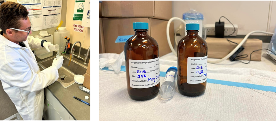
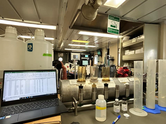
While the research we do in the Great Lakes Food Webs lab typically involves a lot of ‘behind-the-scenes’ work, there is something exciting about getting to participate in a lake-wide cruise of this scale, and seeing the data we work hard to extract from each sample being used by other Canadians and Americans! During the cruise we deployed profiling instruments, collected zooplankton using nets, and measured rates of bacterial and planktonic productivity by spiking water samples with radioactive isotopes of a known quantity and concentration (the Limnos is the only Great Lakes ship licensed to do this work). Now that we are back at the lab’s home base at CCIW, the fun certainly does not stop as we move onto the sample processing, analysis, and data management phase of our work. Over the next few weeks, the lab team and I will perform several assays to determine the concentration of chlorophyll- a and other chemical constituents in samples and ensure that the important information we collected onboard will be safely.
After sampling 17 stations across Lake Erie and covering a distance of approximately 900 kilometers—from Hamilton Harbour in western Lake Ontario, all the way through the Detroit and St. Clair Rivers to the port of Goderich on Lake Huron—we are celebrating a highly successful springtime voyage aboard the Limnos. We cannot wait for our mid-summer cruise!
Pingback: Lake Erie CSMI 2024 : Part II Nine Memorable Experiences - Great Lakes Food Webs
Pingback: Steps & Stages of Field Sampling in the FER Lab - Great Lakes Food Webs
Pingback: Breaking the Ice for the WinterGrab - Great Lakes Food Webs